Coordinate Systems
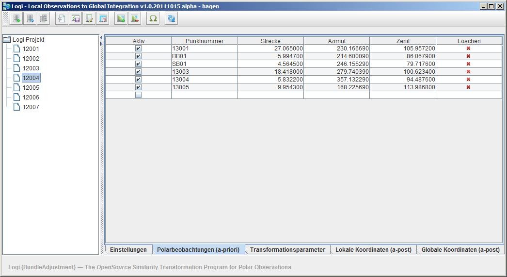
Local Observations to Global Integration v.20120329
Logi (Local Observations to Global Integration) transforms several local coordinate systems (composed of polar measurements) into a global spatial uniform network with respect to the Guide to the Expression of Uncertainty in Measurement (GUM).
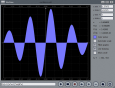
WinDraw v.1.0
This software utility can plot regular or parametric functions, in Cartesian or polar coordinate systems, and is capable to evaluate the roots, minimum and maximum points as well as the first derivative and the integral value of regular functions.

TRANSDAT (Deutsch) v.12 5
TRANSDAT Geosoftware executes coordinate transformations and geodetic datum shifts between lots of coordinate and reference systems of Germany, Europe, America, Australia and world wide in high quality and with high performance: 1.

GeoDLL Deutsch v.14.60
GeoDLL supports the development of geodetic software on various platforms by providing geodetic functions. GeoDLL contains precise calculations on the themes 2D and 3D coordinate transformation, geodetic datum shift and reference system and more.
GeoDLL English v.14.60
GeoDLL supports the development of geodetic software on various platforms by providing geodetic functions. GeoDLL contains precise calculations on the themes 2D and 3D coordinate transformation, geodetic datum shift and reference system and more.
Graphics4VO Examples Program v.5 18
Graphics4VO is developed for use with CA-Visual Objects (Version 2.0 upto 2.8). It is based on 32-Bit-WINDOWS-API. The library allows development of graphics oriented CA-Visual Objects applications for 32-Bit Windows operating systems.

Graphics4VO Graphics DLL v.5 18
Graphics4VO is developed for use with CA-Visual Objects (Version 2.0 upto 2.8). It is based on 32-Bit-WINDOWS-API. The library allows development of graphics oriented CA-Visual Objects applications for 32-Bit Windows operating systems.

Graphics4VO DLL (Deutsch) v.5.00
Graphics4VO is developed for use with CA-Visual Objects (Version 2.0 upto 2.7). It is based on 32-Bit-WINDOWS-API. The library allows development of graphics oriented CA-Visual Objects applications for 32-Bit Windows operating systems.
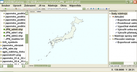
WxGIS Portable v.0.4.1
wxGIS is a useful application that allows you to manage and to organize multiple types of geographic information.
GeoDLL v.18.24
GeoDLL is a Geodetic Development Kit / Geodetic Function Library with worldwide 2D and 3D Coordinate Transformation, Datum Shift, Meridian Convergence and Extra Parameter with highest accuracy. Helmert, NTv2, HARN, INSPIRE, EPSG, DEM and much more
ORTWIN v.13.02
ORTWIN is a program for the inquiry of localities in Germany. It finds postal zip codes, telephone pre selections, coordinates. It performs perimeter searches and distance calculations. It finds landscapes, natural units, snow- and wind load zones.
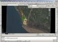
Plex.Earth Tools for AutoCAD
AutoCAD plug-in for advanced geographic interaction with Google Earth. Cover large areas with color imagery. Geo-locate site plans. Unique productivity tool with must-have features necessary for all engineers and architects. Plex.Earth is providing you a